
Did you miss the meeting? Click here for the DPW Flood Mitigation and Adaptation Plan Presentation.
In 2018 the City of Lawrence held a series of meetings to conduct a Municipal Vulnerability Preparedness (MVP) assessment. The purpose of the MVP was to assess the community’s vulnerability to climate change related impacts, explore ways to prepare for extreme weather events, and build greater resilience in the community to ensure a reliable, robust response to protect the city when faced with events like severe storms, heat waves and floods.
The Massachusetts Municipal Vulnerability Preparedness Program (MVP) held a series of meetings with local officials, business leaders, local non-profits and first responders. The group worked to identify what facilities and infrastructure were important to the community, and how those sites were vulnerable.

|
 |
The adaptation plan has several components:
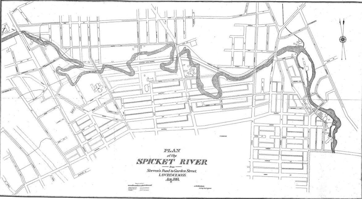
- Reviewing existing flood maps and surveys of the Spicket River to better understand past floods.
- Create a new 3-dimensional model of the river to understand where flood water flows and help predict flood events.
- Develop a list of strategies to minimize flood events, better manage storm water, create flood storage, improve drainage and harden facilities to withstand flooding.
- Engage the public to better inform the community and solicit public comments on the plan.

Community Voices
One of the requirements of the adaptation plan is community engagement. It is important that the community is fully informed about the planning process, the impacts of flooding on the community, and that residents have a chance to be heard.
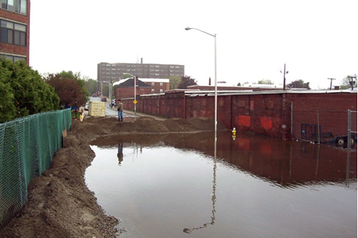
The planners want to know how flooding has affected you in the past. Have you, your family or business been affected by floods? What are some of the concerns you have about flooding? Are there strategies you think should be explored to minimize flood impacts? (Photo: Tennis Lilly)
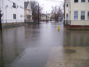
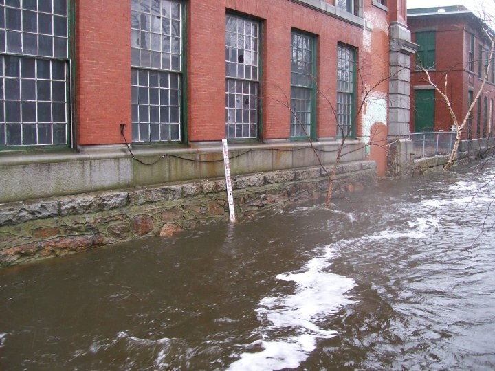
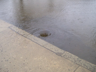
Some residents may not be aware of the flood zone around the Spicket River, or the dangers of climate change and intense storms. People who live near the river are at greater risk of localized street flooding.
Public Art to Inform the CommunityTo promote greater awareness of the river and its flood zones, Groundwork Lawrence is collaborating with Elevated Thought a local artist group, to create public art that illustrates the extent of the flood zone. By helping local residents visualize the full extent of the rivers flood zone, it is hoped that the community will become more engaged with the river and the decisions being made about how to manage flood impacts. |
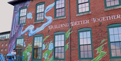 |
Elevated Thought will create art installations to help residents visualize the impacts of flood events. First, a mural at the City Yard will be created that illustrates the 100 year, and 500-year flood levels. Then, ten markers will be placed throughout the neighborhood to show the boundaries of the 100-year flood zone.
The Planning Process
Engineers and community planners are working to gather all of the available data about the ecology of the river and its history of flooding.
By combining this information with new, sophisticated 3-dimensional models, its hopped that we can better understand how the river behaves as it floods and that accurate predictions can be made to respond to flood events in the future. (Photo: Tennis Lilly)
By understanding that areas flood, and under what conditions, the community can better respond to flood events and endangered infrastructure can be protected.
Protecting Critical Facilities
The result of this process is to create options for protecting the City Yard and ensure that the DPW can function when its needed most, during extreme events like storms and floods. Several options could be used, including:
- Improving storm water drainage along the river.
- Creating spaces along the river to hold flood water (increasing flood storage).
- Creating barriers that prevent flood water from reaching critical areas.
Moving critical infrastructure out of the flood zone
Timeline
The Adaptation Plan has 8 components
- Task 1 – Kick-off Meeting
- Task 2 – Community Engagement (We are HERE!)
- Task 3 – Review of Existing Data and Models
- Task 4 – Facility Survey, Operational Assessment, and Spicket River Survey
- Task 5 – Existing Conditions Analysis
- Task 6 – Flood Mitigation Alternatives Analysis
- Task 7 – Facility Flood Vulnerability Assessment and Adaptation Report
-
Task 8 – Case Study
We want to hear from you!
Do you have questions about the project, ideas on how to protect the City Yard or other parts of the community? What is your experience of living near the Spicket River like? Have you been affected by flooding? To learn how you can get involved click here.